
Low-lying mountains, lush vegetation, lightly wooded areas and extensive trails contribute to Ireland’s walkability while the mild climate and cute-as-pie villages provide even more encouragement to put on those boots and get out of the hotel for a hike. There are numerous paths to choose from and finding a distance and difficulty that suit your circumstances is relatively easy.
Kerry Way
 https://www.flickr.com/photos/kristinlucco/
The 214 km trails takes about nine days and is the longest of the National Waymarked Trails in the country. The trek, which uses coach roads and old droving paths, starts in the middle of Killarney and within minutes takes you past historic Muckross House and along the shores of Lough Leane. The terrain changes constantly along the route and sights include coastal vistas, waterfalls, valleys and several delightful villages.
There are several connecting pathways that let walkers create shorter or longer adventures, and maps that include the best camping spots depending on your walking pace. For daywalks, trekkers can hop between B&Bs along the Ring of Kerry scenic drive and explore Kerry Way and the nearby interconnecting trails at each stop.
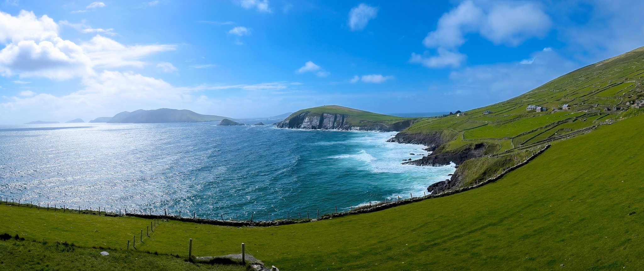
Dingle Way
A bit shorter than Kerry at 179 km, the Dingle Way has more elevation changes and requires a bit more effort to complete. The trail circles the Dingle Peninsula and has diverse scenery along the route, sometimes taking you from a quiet field to a view of the Atlantic in just a few steps. The trail includes walks along the beaches of Maharess and takes hikers past standing stones, beehive huts and ogham stones – all visible from the trail. Even more archeological sights can be seen by those with enough time and energy to take a few detours.
 https://www.flickr.com/photos/evocateur/
The trail travels through many villages and the next possible stopping point is never more than a few hours away. Those traveling light can rely on purchasing food as they travel and the larger villages generally have a B&B or pub with a room available for the night.
Causeway Coastal Route
 https://www.flickr.com/photos/qole/
The coast of Northern Ireland is extremely varied and scenic, switching from beach to cliffs to scrambling over rocks. The Causeway trail is a short 18 km stroll through some of the most interesting sections including the Carrick a Rede Rope Bridge to Carrick a Rede island and ending at the Giants Causeway.
The first beach section is a pleasant stroll ending in some serious rock scrambling to leave the coast and return to firmer ground. The trail here can be inaccessible at high tide but may be bypassed by accessing the road at Portbradden. The route continues along the coast offering some delightful views until reaching the hexagonal stones that constitute the Giants Causeway.
The trail ends without looping and trekkers will either need to catch a bus back to the start or hike the return route. A visitors centre nearby can help with arrangements or provide refreshments for the round trip.
Connemara Way
Starting on the edge of Lough Comb, the 55 km route follows the edge of the lake – the second largest in Ireland – travelling north through boggy and mountainous wilderness before coming to the village of Maam Bridge. Much of the trail skirts the higher ground, sticking to the valleys and fields. Sections of the trail pass through once-populated areas that were decimated by the Great Famine although villages still dot the region.
The walk normally takes two days and takes travellers through quiet countryside towered over by quartz peaks. Only a few sections of the path are on roadways, the rest of the trail is dirt or rock. Many areas contain bogs or small lakes and the trek can be very soggy during wet weather.
Wicklow Way
 https://www.flickr.com/photos/andhi/
Another National Waymarked Trail, Wicklow Way stretches 130 km, traverses three counties and has some challenging elevation changes as it crosses the Wicklow Mountains. The trail takes somewhere between four and ten days to complete with most striving for six.
The trek starts in Dublin and travels through forests, over mountains, around lakes and valleys, and follows small country roads. Some sections are on private land while others are maintained by the forest service. Problems with erosion and rights of way occasionally lead to route changes and users should consult a map before setting out.
Torc Mountain Walking Route
Short and difficult, the 7.5 km walk takes almost three hours but provides a stunning view from the top. Despite the climb, the paths are wide and well-maintained, allowing even small children to complete the climb if given enough time.
The summit of Torc Mountain has 360 degree views of Killarney, County Kerry and Killarney National Park. Connecting trails take visitors to Mangerton Mountain or the Torc Waterfall at the base of the main mountain.