

The United States as we know it exists in part because of the Erie Canal.
Completed in 1825, the Erie Canal linked the Atlantic Ocean to the Great Lakes, allowing goods and ideas to flow between the humming docks of New York City and the nation’s interior. New York City became the young country’s pre-eminent port; New York State flourished. And it all happened on the water.
Before the canal, things had to be moved by man or beast. The Canal provided a fast and effective water route from New York City to the Midwest. In recognition of its importance, then-governor Theodore Roosevelt expanded the canal system to compete with the railroad in the late 19th- and early 20th-centuries. New York – as well as the young United States – rapidly transitioned from a farming economy to an industrial one.

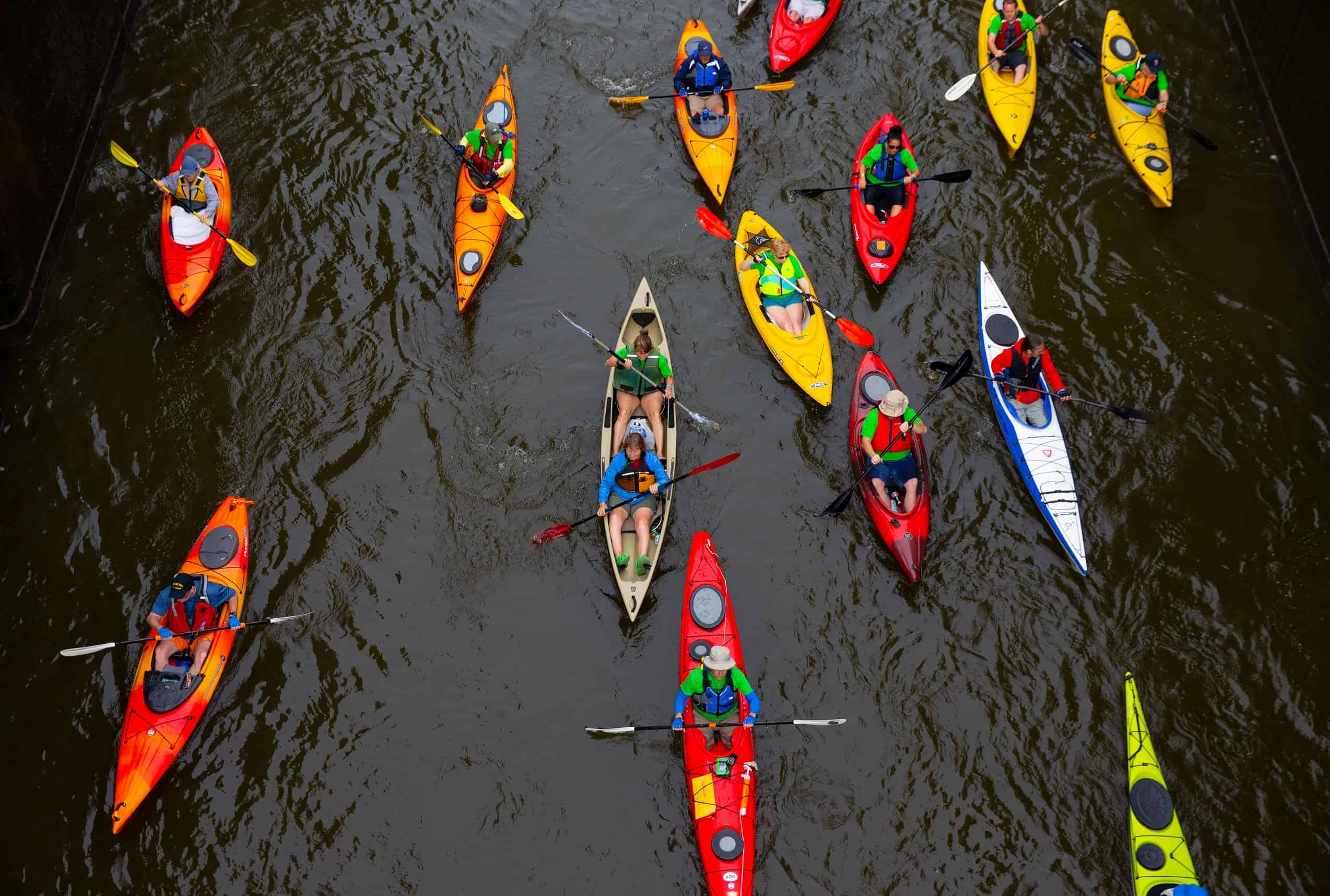
Artists took note. People like Thomas Cole travelled upstate via steamship, with paintbrushes in-hand. Today, we can see some of what they saw and, thanks to the computers we all carry in our pockets, even compare our view against that of the paintings by members of what we now call the Hudson River School. We can wave to boaters and kayakers on the water, bike to historical sites like Fort Ticonderoga, or take a bite of a big apple, freshly picked from an organic farm. We can watch the sun set at a winery, or traverse the world’s longest pedestrian bridge. If you can’t bear to look down 64 metres to the Hudson River below, you can look north to the Catskills or south to the Hudson Highlands.
Will you hike, bike, walk, pedal or paddle?
 New York Power Authority
 New York Power Authority
Over the years, the state created 560+ kilometres of trails. Many of these trails run parallel to the canal system, which after falling into disuse with the rise of railroads and highways, have now been reborn as a recreation way (although commercial traffic continues to this day). The canal system was named to the National Register of Historic Places in 2014 and landmarked in 2017, so these routes are serving a new purpose as thruways for adventurers and amblers alike. New York’s Canal Corporation also maintains 843 kilometres of waterways, including locks and launch sites for recreational use. There are plenty of campsites too.
The Empire State Trail to open in 2020

In 2017, Governor Andrew Cuomo announced an exciting plan to link the various trails crisscrossing some of the most beautiful areas of the whole country. Upon completion in 2020, The Empire State Trail will feature an unbroken 1,207-kilometre route, roughly in the shape of a sideways T: the Erie Canalway Trail will run from Buffalo to Albany (east to west), while the north-south route will link New York City to the Canadian border, through the Hudson River and Champlain Valleys. Eventually every New Yorker will literally be just steps away from a trail, regardless of where they live.
“What’s truly thrilling about the Empire State Trail isn’t just that it will be the longest multi-use recreational path in the whole US, but that it will be open year-round,” said Andy Beers, Director of the EST Project. “That means snow-shoeing, sledding, cross-country skiing, as well as running, hiking and biking. You can wander for a while, then head home, or plan a multi-day trip by linking to other trails. And we’re making every step ADA-complaint, so everyone will be able to enjoy our state’s majesty.”
Set your sights on adventure and fun along the 843-km Erie Canal & NYS Canal system and the 1,200-km Empire State Trail!
The Empire State Trail | Erie Canalway | Cycle The Erie Canal | New York State Canals | New York Parks & Trails