
Sitting on the edge of the Atlantic Ocean, the island can experience difficult weather and difficult terrain in very remote areas. From tablelands to mountains, trekkers that choose to traverse the island can find almost any condition and difficulty they’d like to experience. Not surprisingly these are the very things that make Newfoundland so amazing to hike.
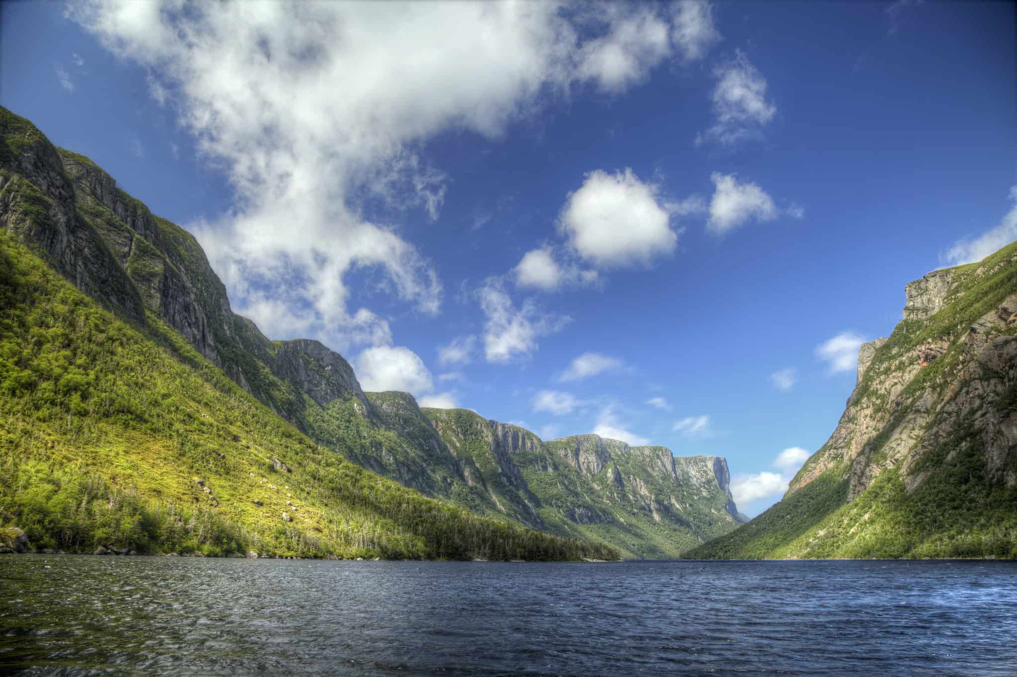
Gros Morne National Park
 https://www.flickr.com/photos/grosmornecoop/
This is the second largest national park in eastern Canada and takes its name from the peak within the park. Crisscrossing the 1,800 square km of land are more than 100 km of trails ranging from a light stroll through the woods to trails that will have you begging for mercy. The developed trails are well marked in most areas and those labelled ‘easy’ can be completed by almost anyone.
Although the marked trails have bridges and staircases added in to difficult sections, don’t make the mistake of thinking the trails will be easier because of that. The Green Gardens hike, for example, is a solid six hours of scrambling up and down rocks to reach a cool sea cave and a number of other geological formations worth looking at. Even the shorter Snug Harbour trail requires some effort and possibly a ford across Western Brook.
The Long Range Traverse
 https://www.flickr.com/photos/29271939@N02/
A multi-day adventure that takes you through the middle of nowhere, this hike is so remote that you are issued a location device and you’ll need to pass a navigation test before you receive your permit. A gps is highly recommended as there is no marked trail and you have only your map to rely on.
The initial section of trail is fairly easy to follow having been well-marked by the feet of many hopeful hikers. Once the trail hits the rocky section, however, you’re on your own. Follow your map carefully and check your coordinates on the gps. Head for the campsites and if you decide to camp off the trail, be prepared for bear and other wildlife.
The entire route is about 35 km not counting backtracking and excursions to view waterfalls and lakes. The scenery is incredible and most hikers encounter a significant number of wildlife along the way.
East Coast Trail
 https://www.flickr.com/photos/ingoism/
The entire route is more than 540 km, continuing up the coast and terminating at Cape St. Francis. Along the way you’ll hug the coastline for much of the distance, getting amazing views and stopping in a series of old towns and villages as you travel. Most of the path actually follows walking trails that have been used for centuries by the residents of these local villages.
The trail is partitioned into one-day sections in the completed portion that stretches from Pouch Cove near St. John’s to Cappahayden. Rest stops are easy to plan and many of the 32 villages you’ll pass through have B&Bs that cater to trail-walkers. Several historic sights are marked on the maps and trekkers should always keep an eye towards the sea looking for a passing iceberg or the occasional pod of whales.
Terra Nova National Park
 https://www.flickr.com/photos/sam-leitz/
The park contains examples of the incredibly diverse terrain of the region including rocky coastline, boreal forestland, wetlands and rolling hills. The 100-or-so km of trails provide access to some of the most interesting features and spectacular viewpoints.
Although a bit steep in spots, Malady Head trail is mostly accessible with boardwalks and handrails in the tricky spots. The path travels through a mature spruce forest before opening on to Malady Head and amazing views of Southwest Arm and the Eastport Peninsula. The Ochre Hill trail is another medium-difficulty trek that leads hikers to incredible views at Ochre Hill Lookout.
Often considered the best hike, Outport trail is also the longest. At 48 km you’ll want to plan carefully and check in with the staff before setting out. The path includes several steep sections, but nothing technically difficult. Get a backcountry camping permit if you plan to travel the entire trail.
International Appalachian Trail
 https://www.flickr.com/photos/99116641@N00/
This phenomenal trail runs from Belle Isle, NL to Mount Katahdin, Maine (US) and connects to the Eastern Continental Trail that continues all the way to Key West, Florida. The trail is being constructed in sections with several excellent portions already complete in Newfoundland.
The Newfoundland section of the trail begins at Channel-Port aux Basque and winds up the western coast of the island to Cape Bauld at the northernmost tip, passing through three National Parks and traversing The Cabox along the way.
Many sections utilize logging and secondary roads but be prepared for soggy sections and deep snow depending on the season. Many portions can be travelled in one to four day sprints allowing trekkers yp choose difficulty levels as well as the amount of time they’re prepared to spend.